At Skyline Drone Mapping, we don’t offer generic drone services we deliver industry-grade aerial intelligence built to optimize, scale, and dominate your project from the sky. Whether you’re in construction, ranching, real estate, energy, or government, our high-precision drone solutions provide actionable data with sub-inch precision faster, safer, and smarter than traditional methods.
Inspect roofs, towers, infrastructure, or hard-to-reach areas with high-resolution imagery and 3D model options for data you can trust.
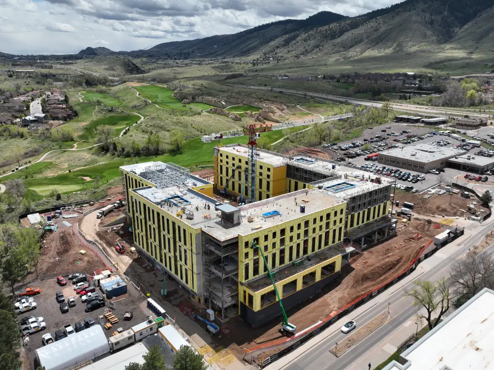
Construction Mapping Services
Skyline Drone Mapping helps construction companies gather high-precision topographic data, site plans, and progress tracking in real-time. We provide accurate measurements that allow you to better plan your construction projects, monitor progress, and make timely adjustments.
Agricultural Mapping Services
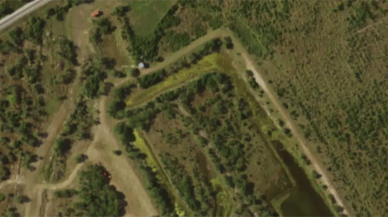
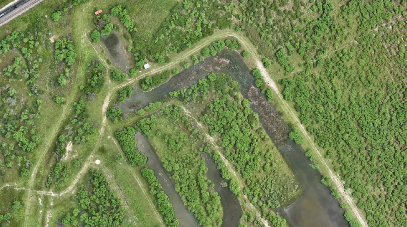
With Skyline’s agricultural mapping solutions, you can accurately monitor crop health, assess field conditions, and plan more effectively. Our drone technology provides high-resolution imagery and precise data that helps farmers make data-driven decisions, resulting in improved yields and reduced costs.
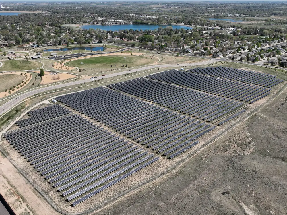
Energy & Utilities Mapping Services
Skyline Drone Mapping provides high-precision aerial data for energy and utilities companies, helping them maintain infrastructure, monitor sites, and comply with safety regulations. Our drone mapping services allow for quicker and safer inspections, providing you with the data necessary to ensure operational efficiency and risk mitigation.
Mining & Quarry Mapping Services
Skyline’s drone mapping solutions allow mining and quarry operators to assess resources, plan excavation, and monitor safety standards with precision. Our aerial mapping ensures that you get the most accurate data for resource management, environmental assessments, and regulatory compliance.
Transportation & Infrastructure Mapping Services
Skyline Drone Mapping helps transportation authorities and infrastructure companies optimize their projects with accurate data. Whether you’re assessing road conditions, planning new infrastructure, or monitoring traffic flow, our drones provide the precision and speed needed for success.
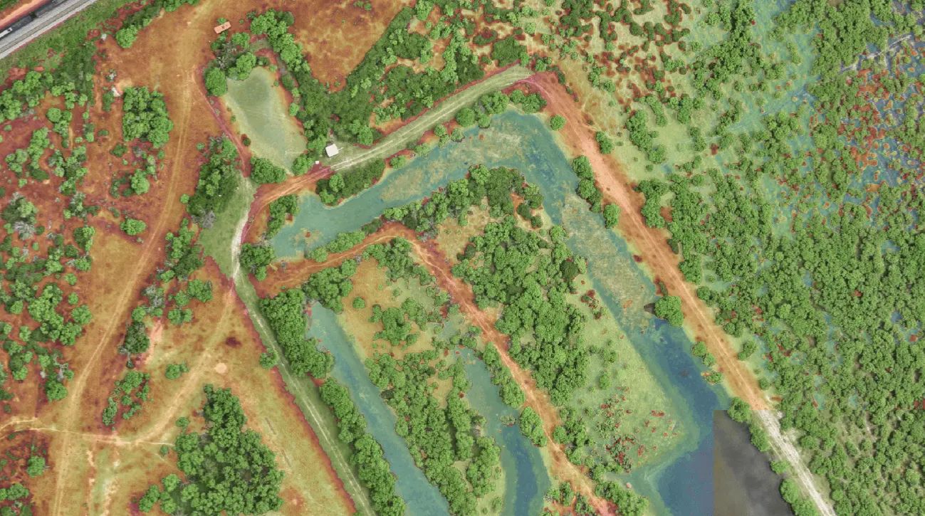
Cut/fill, contours, volume, and terrain measured to the centimeter. We deliver photorealistic orthomosaics and 3D data with centimeter-grade accuracy. No more manual surveys or rework delays. Just clean, actionable data.
From flight to final files fast. Get real-time visuals, progress tracking, and inspection-ready exports in record time. While traditional survey crews lag, we’re already in post-production.
High-output data. Low-overhead ops. Reduce boots on the ground, cut fuel and labor expenses, and eliminate rework. Skyline streamlines your workflow while boosting quality and ROI.
Keep your team out of hazardous zones. We fly where it’s unsafe to walk landfills, slopes, structures, and active job sites. Our drones collect the data, your team stays protected.
Contact
© All Rights Reserved. Powered by Building Brands Marketing.